Drakeholes Tunnel
Introduction
The photograph on this page of Drakeholes Tunnel by Trevor Littlewood as part of the Geograph project.
The Geograph project started in 2005 with the aim of publishing, organising and preserving representative images for every square kilometre of Great Britain, Ireland and the Isle of Man.

There are currently over 7.5m images from over 14,400 individuals and you can help contribute to the project by visiting https://www.geograph.org.uk
Drakeholes Tunnel
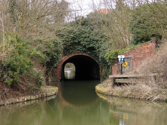
Image: © Trevor Littlewood Taken: 12 Mar 2005
The 154 yard Drakeholes Tunnel on the Chesterfield Canal was built as can be seen, without a towpath meaning that narrowboats would need to be 'legged' through and the towing horses led over the top.
Images are licensed for reuse under creativecommons.org/licenses/by-sa/2.0
Image Location
Latitude
53.406511
Longitude
-0.939028