Flooded Ridge and Furrows at Long Marston, near Tring
Introduction
The photograph on this page of Flooded Ridge and Furrows at Long Marston, near Tring by Chris Reynolds as part of the Geograph project.
The Geograph project started in 2005 with the aim of publishing, organising and preserving representative images for every square kilometre of Great Britain, Ireland and the Isle of Man.

There are currently over 7.5m images from over 14,400 individuals and you can help contribute to the project by visiting https://www.geograph.org.uk
Flooded Ridge and Furrows at Long Marston, near Tring
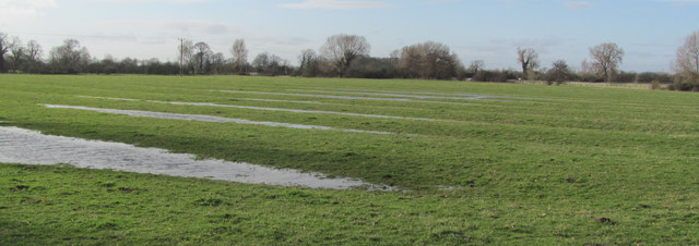
Image: © Chris Reynolds Taken: 2 Feb 2014
The recent very wet weather has left a lot of standing water in the fields and the long parallel pools on this field between Astrope Lane and the original Long Marston Church Image clearly show the ridges. It should be realized that ridge and furrow cultivation on such flat and easily waterlogged ground help with the drainage.
Images are licensed for reuse under creativecommons.org/licenses/by-sa/2.0
Image Location
Latitude
51.830414
Longitude
-0.702469