Main Street, Hoby
Introduction
The photograph on this page of Main Street, Hoby by Alan Murray-Rust as part of the Geograph project.
The Geograph project started in 2005 with the aim of publishing, organising and preserving representative images for every square kilometre of Great Britain, Ireland and the Isle of Man.

There are currently over 7.5m images from over 14,400 individuals and you can help contribute to the project by visiting https://www.geograph.org.uk
Main Street, Hoby
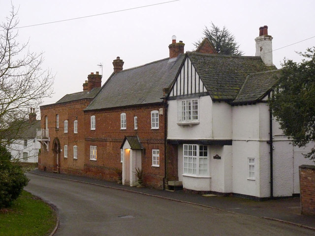
Image: © Alan Murray-Rust Taken: 24 Jan 2014
The middle house is Church Gables, an early 18th century building in Flemish bond brickwork and with a slate roof. It is Listed Grade II. Beyond is Chantry House, not listed but noted by the local Conservation Area Appraisal as a significant visual contribution to the village.
Images are licensed for reuse under creativecommons.org/licenses/by-sa/2.0
Image Location
Latitude
52.749097
Longitude
-1.010326