Camlas Clydach Canal
Introduction
The photograph on this page of Camlas Clydach Canal by Alan Richards as part of the Geograph project.
The Geograph project started in 2005 with the aim of publishing, organising and preserving representative images for every square kilometre of Great Britain, Ireland and the Isle of Man.

There are currently over 7.5m images from over 14,400 individuals and you can help contribute to the project by visiting https://www.geograph.org.uk
Camlas Clydach Canal
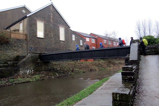
Image: © Alan Richards Taken: 26 Jan 2014
Cerddwyr yn croesi pontdroed a rychwanta Gamlas Abertawe. Adeiladwyd y gamlas rhwng 1794 a 1798 o Abercraf i Abertawe, pellter o 16 milltir a chludid glo, dur a haearn arni. Fe'i caewyd yn 1931. Yn 1981 sefydlwyd Cymdeithas Gamlas Abertawe er mwyn ei hadfer. Y capel yn y cefndir yw Calfaria. Walkers crossing a footbridge spanning the Swansea Canal. The canal, built between 1794 and 1798 and sixteen miles in length, linked Abercraf with Swansea and transported mainly coal, steel and iron. The canal finally closed in 1931. In 1981 the Swansea Canal Society was formed and is committed in restoring the old waterway.
Images are licensed for reuse under creativecommons.org/licenses/by-sa/2.0
Image Location
Latitude
51.693757
Longitude
-3.897456