
Rive Ditch: Twixt West Byfleet and Woodham
Introduction
The photograph on this page of Rive Ditch: Twixt West Byfleet and Woodham by Nigel Cox as part of the Geograph project.
The Geograph project started in 2005 with the aim of publishing, organising and preserving representative images for every square kilometre of Great Britain, Ireland and the Isle of Man.

There are currently over 7.5m images from over 14,400 individuals and you can help contribute to the project by visiting https://www.geograph.org.uk
Rive Ditch: Twixt West Byfleet and Woodham
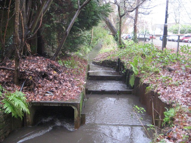
Image: © Nigel Cox Taken: 7 Jan 2014
Although only a minor watercourse and a tributary of the River Wey, Rive Ditch here forms the boundary between West Byfleet and Woodham, and judging by the thickness of the line on the map, other boundaries further up the hierarchical scale too. The ditch splits with an odd structure here, the right side going down through a series of stop boards, and the left side through a small box culvert.
Images are licensed for reuse under creativecommons.org/licenses/by-sa/2.0
Image Location

Latitude
51.340753
Longitude
-0.509025