Extremely high River Parrett
Introduction
The photograph on this page of Extremely high River Parrett by Martin Southwood as part of the Geograph project.
The Geograph project started in 2005 with the aim of publishing, organising and preserving representative images for every square kilometre of Great Britain, Ireland and the Isle of Man.

There are currently over 7.5m images from over 14,400 individuals and you can help contribute to the project by visiting https://www.geograph.org.uk
Extremely high River Parrett
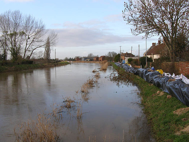
Image: © Martin Southwood Taken: 22 Jan 2014
A view of the extremely high River Parrett at Burrowbridge showing sandbags in place on the east (right) bank top in a last ditch effort to prevent localized flooding. The small road behind the west bank is closed three miles ahead, the small road behind and below the east bank is still clear to Westonzoyland and Bridgwater, the road behind us is flooded to about six inches but passable, and the main A361 to the west is totally closed!
Images are licensed for reuse under creativecommons.org/licenses/by-sa/2.0
Image Location
Latitude
51.070211
Longitude
-2.919238