Junction of the Rivers Parrett and Tone from Burrow Mump
Introduction
The photograph on this page of Junction of the Rivers Parrett and Tone from Burrow Mump by Martin Southwood as part of the Geograph project.
The Geograph project started in 2005 with the aim of publishing, organising and preserving representative images for every square kilometre of Great Britain, Ireland and the Isle of Man.

There are currently over 7.5m images from over 14,400 individuals and you can help contribute to the project by visiting https://www.geograph.org.uk
Junction of the Rivers Parrett and Tone from Burrow Mump
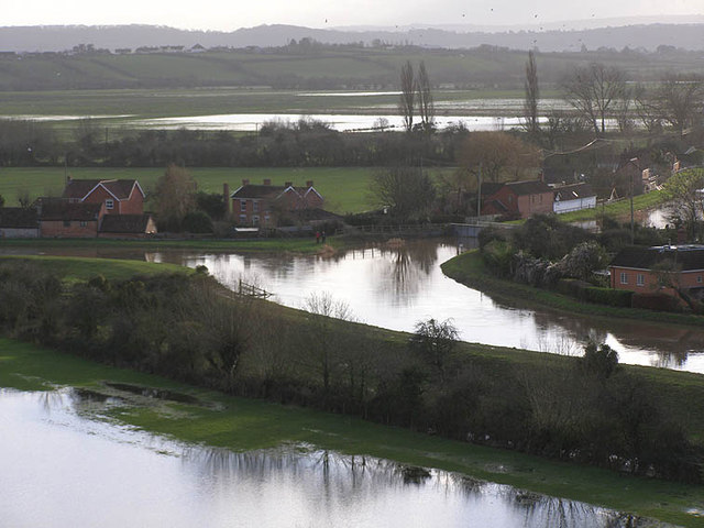
Image: © Martin Southwood Taken: 22 Jan 2014
This view from on top of Burrow Mump shows the junction of the two rivers and also the flooding of the surrounding area, the fields right below and Stan Moor in the distance. The actual river levels are higher than when I took the reverse view approx. two weeks ago.
Images are licensed for reuse under creativecommons.org/licenses/by-sa/2.0
Image Location
Latitude
51.067079
Longitude
-2.917178