The Thames at Isleworth Ait: view upstream, January 2014
Introduction
The photograph on this page of The Thames at Isleworth Ait: view upstream, January 2014 by Stefan Czapski as part of the Geograph project.
The Geograph project started in 2005 with the aim of publishing, organising and preserving representative images for every square kilometre of Great Britain, Ireland and the Isle of Man.

There are currently over 7.5m images from over 14,400 individuals and you can help contribute to the project by visiting https://www.geograph.org.uk
The Thames at Isleworth Ait: view upstream, January 2014
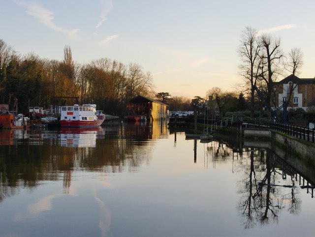
Image: © Stefan Czapski Taken: 19 Jan 2014
View upstream from Town Wharf - with the Ait (an island in mid-river) on the left. As with many other places along the Thames, Isleworth riverside has changed greatly in the last fifty years, boatyards, scrapyards and other industrial uses giving way to polite residential development. But gentrification has not yet reached the Ait - along the shore of the island there are still boatbuilders' premises and moorings for a motley assortment of river-going vessels.
Images are licensed for reuse under creativecommons.org/licenses/by-sa/2.0
Image Location
Latitude
51.467256
Longitude
-0.321343