Rowland Hill's Almshouses, Wotton-under-Edge
Introduction
The photograph on this page of Rowland Hill's Almshouses, Wotton-under-Edge by Jaggery as part of the Geograph project.
The Geograph project started in 2005 with the aim of publishing, organising and preserving representative images for every square kilometre of Great Britain, Ireland and the Isle of Man.

There are currently over 7.5m images from over 14,400 individuals and you can help contribute to the project by visiting https://www.geograph.org.uk
Rowland Hill's Almshouses, Wotton-under-Edge
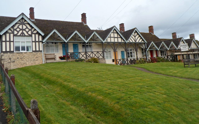
Image: © Jaggery Taken: 28 Oct 2012
Viewed from Tabernacle Pitch. The almshouses were erected in 1887 in memory of the Reverend Rowland Hill. Grade II listed in 1984.
Images are licensed for reuse under creativecommons.org/licenses/by-sa/2.0
Image Location
Latitude
51.639412
Longitude
-2.352973