Ebenezer, Rhymney
Introduction
The photograph on this page of Ebenezer, Rhymney by Jaggery as part of the Geograph project.
The Geograph project started in 2005 with the aim of publishing, organising and preserving representative images for every square kilometre of Great Britain, Ireland and the Isle of Man.

There are currently over 7.5m images from over 14,400 individuals and you can help contribute to the project by visiting https://www.geograph.org.uk
Ebenezer, Rhymney
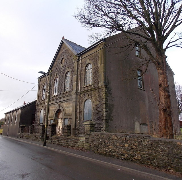
Image: © Jaggery Taken: 17 Jan 2014
Now in residential use, the former chapel is on the north side of Carno Street, opposite a row of houses. Inscriptions in Welsh on the building show that it is a 1906 rebuild of the 1846 original. Grade II listed (as Ebenezer Calvinistic Methodist Chapel including vestry) in 1999. The vestry is on the left.
Images are licensed for reuse under creativecommons.org/licenses/by-sa/2.0
Image Location
Latitude
51.768167
Longitude
-3.291158