Walk along the old town defences of Sandwich
Introduction
The photograph on this page of Walk along the old town defences of Sandwich by Marathon as part of the Geograph project.
The Geograph project started in 2005 with the aim of publishing, organising and preserving representative images for every square kilometre of Great Britain, Ireland and the Isle of Man.

There are currently over 7.5m images from over 14,400 individuals and you can help contribute to the project by visiting https://www.geograph.org.uk
Walk along the old town defences of Sandwich
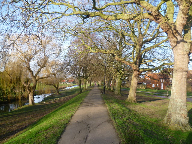
Image: © Marathon Taken: 12 Jan 2014
This walk is on the western stretch of the old town defences for Sandwich, first built in 1384. The water on the left is the Delf Stream. This was greatly improved by Dutch water engineers in the later 15th century. They built many sluices so that all the fields could be irrigated. Their network of artificial streams formed the water supply and sewers for the whole of Sandwich until the late 19th century. In the distance on the left is The Butts - see http://www.geograph.org.uk/photo/3815069 for more information.
Images are licensed for reuse under creativecommons.org/licenses/by-sa/2.0
Image Location


Leaflet Map data © OpenStreetMap
Latitude
51.27493
Longitude
1.335648