The centre of Sheffield seen from afar
Introduction
The photograph on this page of The centre of Sheffield seen from afar by Neil Theasby as part of the Geograph project.
The Geograph project started in 2005 with the aim of publishing, organising and preserving representative images for every square kilometre of Great Britain, Ireland and the Isle of Man.

There are currently over 7.5m images from over 14,400 individuals and you can help contribute to the project by visiting https://www.geograph.org.uk
The centre of Sheffield seen from afar
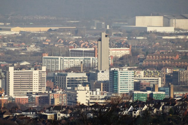
Image: © Neil Theasby Taken: 14 Jan 2014
This picture was taken from Ringinglow Moor - some five miles to the west of the city centre. The tall building in the centre is St. Paul's Tower - sometimes known as "City Lofts" - a residential block and the tallest building in Sheffield.
Images are licensed for reuse under creativecommons.org/licenses/by-sa/2.0
Image Location
Latitude
53.377867
Longitude
-1.470082