The Thames & Medway Canal near Mark Lane
Introduction
The photograph on this page of The Thames & Medway Canal near Mark Lane by Marathon as part of the Geograph project.
The Geograph project started in 2005 with the aim of publishing, organising and preserving representative images for every square kilometre of Great Britain, Ireland and the Isle of Man.

There are currently over 7.5m images from over 14,400 individuals and you can help contribute to the project by visiting https://www.geograph.org.uk
The Thames & Medway Canal near Mark Lane
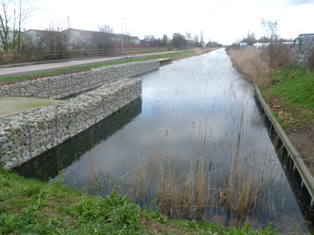
Image: © Marathon Taken: 9 Jan 2014
After weeks of heavy rain and flooding inland The Thames & Medway Canal appeared to be much fuller than usual. This part of the Thames & Medway Canal was opened between Gravesend and Higham in 1801 and continued in use until 1934. A more typical view of the canal a little way to the east can be seen at http://www.geograph.org.uk/photo/2118631 To find out more about the Thames & Medway Canal and the plans to restore it visit http://www.thamesmedway.co.uk/
Images are licensed for reuse under creativecommons.org/licenses/by-sa/2.0
Image Location
Latitude
51.441519
Longitude
0.394037