Bentley Methodist Church
Introduction
The photograph on this page of Bentley Methodist Church by Robert Neilson as part of the Geograph project.
The Geograph project started in 2005 with the aim of publishing, organising and preserving representative images for every square kilometre of Great Britain, Ireland and the Isle of Man.

There are currently over 7.5m images from over 14,400 individuals and you can help contribute to the project by visiting https://www.geograph.org.uk
Bentley Methodist Church
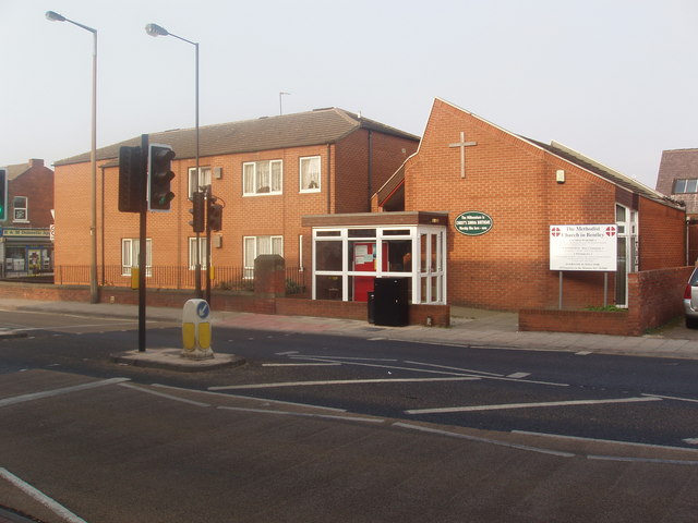
Image: © Robert Neilson Taken: 26 Mar 2007
The present Methodist Chapel was built in the late 1970s to replace a much larger Victorian building which was too large for the needs of the congregation of day. Adjacent land was used for a social housing development [seen in part to the side] which, presumably, helped to fund the new church premises.
Images are licensed for reuse under creativecommons.org/licenses/by-sa/2.0
Image Location
Latitude
53.545796
Longitude
-1.147289