Five Bearpacker almshouses, Wotton-under-Edge
Introduction
The photograph on this page of Five Bearpacker almshouses, Wotton-under-Edge by Jaggery as part of the Geograph project.
The Geograph project started in 2005 with the aim of publishing, organising and preserving representative images for every square kilometre of Great Britain, Ireland and the Isle of Man.

There are currently over 7.5m images from over 14,400 individuals and you can help contribute to the project by visiting https://www.geograph.org.uk
Five Bearpacker almshouses, Wotton-under-Edge
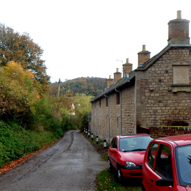
Image: © Jaggery Taken: 28 Oct 2012
Viewed along Adey's Lane. In view are 5 of 10 Bearpacker almshouses. The inscription on the side wall states that the almshouses (described as tenements) with the gardens adjacent were given by Miss A Bearpacker for the occupation of five poor and infirm men, old inhabitants of the parish of Wotton-under-Edge and members of the established Church of England. The year shown is MDCCCXXXVII (1837). http://www.geograph.org.uk/photo/3811198 to the other 5 almshouses.
Images are licensed for reuse under creativecommons.org/licenses/by-sa/2.0
Image Location
Latitude
51.640416
Longitude
-2.348068