Coventry: A444 road sign and the Ricoh Arena
Introduction
The photograph on this page of Coventry: A444 road sign and the Ricoh Arena by Chris Downer as part of the Geograph project.
The Geograph project started in 2005 with the aim of publishing, organising and preserving representative images for every square kilometre of Great Britain, Ireland and the Isle of Man.

There are currently over 7.5m images from over 14,400 individuals and you can help contribute to the project by visiting https://www.geograph.org.uk
Coventry: A444 road sign and the Ricoh Arena
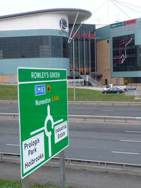
Image: © Chris Downer Taken: 23 Nov 2013
The direction sign is green because it is a primary route (trunk road) and is therefore marked in green on road atlases. The white panels for the side-road destinations denote that these are local names on non-primary routes; these would previously have been on a separate sign white in colour, but the system was changed a few years ago. In the background is the main entrance to Image
Images are licensed for reuse under creativecommons.org/licenses/by-sa/2.0
Image Location
Latitude
52.447496
Longitude
-1.498085