Wharf House near Leominster
Introduction
The photograph on this page of Wharf House near Leominster by Jaggery as part of the Geograph project.
The Geograph project started in 2005 with the aim of publishing, organising and preserving representative images for every square kilometre of Great Britain, Ireland and the Isle of Man.

There are currently over 7.5m images from over 14,400 individuals and you can help contribute to the project by visiting https://www.geograph.org.uk
Wharf House near Leominster
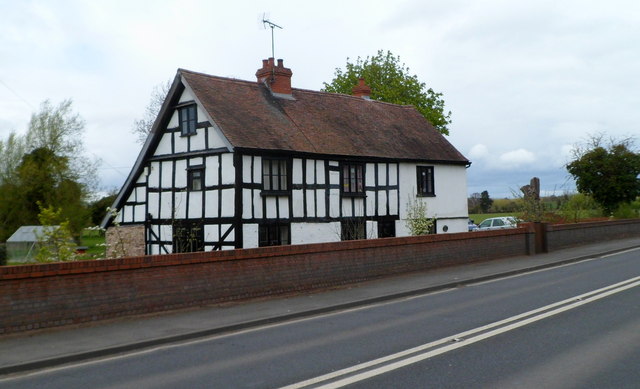
Image: © Jaggery Taken: 22 Apr 2012
Viewed across the A49 from the corner of Hay Lane. The timber-framed house dates from the 17th century, with later additions and alterations. Grade II listed in 1987. The house was not originally named Wharf House. When a canal and wharf were built nearby, the building was taken over by the canal company. All traces of the canal were filled in long ago, leaving only the name of the house as a relic.
Images are licensed for reuse under creativecommons.org/licenses/by-sa/2.0
Image Location


Leaflet Map data © OpenStreetMap
Latitude
52.235324
Longitude
-2.726399