Spring in the fields
Introduction
The photograph on this page of Spring in the fields by Ken Brockway as part of the Geograph project.
The Geograph project started in 2005 with the aim of publishing, organising and preserving representative images for every square kilometre of Great Britain, Ireland and the Isle of Man.

There are currently over 7.5m images from over 14,400 individuals and you can help contribute to the project by visiting https://www.geograph.org.uk
Spring in the fields
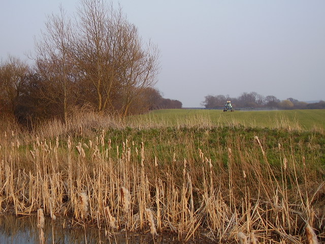
Image: © Ken Brockway Taken: 27 Mar 2007
A wide boom on the tractor sprays the field in no time. In the distance is Muston Gorse Covert. In the foreground the disused Grantham canal. Among the trees on the left is a feeder for the canal from Knipton Reservoir. Close inspection of the map will reveal that it is not a continuous water course. Close inspection on the ground might reveal that for much of its journey the water travels in a brick tunnel. A requirement of the Duke of Rutland when the canal and its feeder stream was constructed.
Images are licensed for reuse under creativecommons.org/licenses/by-sa/2.0
Image Location
Latitude
52.914255
Longitude
-0.779921