Wraysbury: The Baptist Church
Introduction
The photograph on this page of Wraysbury: The Baptist Church by Nigel Cox as part of the Geograph project.
The Geograph project started in 2005 with the aim of publishing, organising and preserving representative images for every square kilometre of Great Britain, Ireland and the Isle of Man.

There are currently over 7.5m images from over 14,400 individuals and you can help contribute to the project by visiting https://www.geograph.org.uk
Wraysbury: The Baptist Church
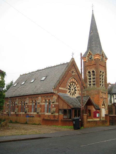
Image: © Nigel Cox Taken: 12 Dec 2013
There are several interesting buildings in Wraysbury but very few are nationally listed. This is one of the interesting and surprisingly unlisted ones, a nicely proportioned Victorian church with a fine separate tower, and, on close inspection, both with a lot of intricate and pleasing detail. Up to and including the map of 1920 the Ordnance Survey spelt Wraysbury as Wyrardisbury, both as the name of the village and as the name of the civil parish. For a while in the 1930s the OS offered both spellings until eventually the modern day one only was accepted.
Images are licensed for reuse under creativecommons.org/licenses/by-sa/2.0
Image Location
Latitude
51.457229
Longitude
-0.554172