Jaunty angle
Introduction
The photograph on this page of Jaunty angle by Neil Owen as part of the Geograph project.
The Geograph project started in 2005 with the aim of publishing, organising and preserving representative images for every square kilometre of Great Britain, Ireland and the Isle of Man.

There are currently over 7.5m images from over 14,400 individuals and you can help contribute to the project by visiting https://www.geograph.org.uk
Jaunty angle
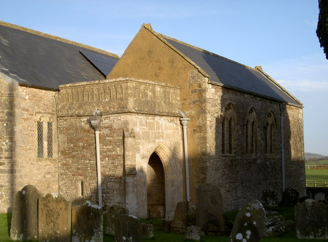
Image: © Neil Owen Taken: 31 Dec 2013
The various parts of St Bridget's church area somewhat at odds to each other and have a distinct disunity of verticals; however, it does lend a certain charm. The original stonework is Norman and the south entrance is of this period. Later works in the following centuries brought many changes and additions and clearly have not necessarily kept to the same lines. But perhaps the most relevant addition concerns the solar panels on the roof. These were installed in 2012 after permission was granted from the diocesan advisory committee on church buildings and also North Somerset Council. But in particular English Heritage gave permission as the church is Grade I listed. The fifteen panels (a 3.6kWp installation) are generating about 2,500kWH of electricity annually, which when fed back into the grid will earn the church a significant amount. It also reduces the carbon footprint by about 1,400kg. See Image] for more views.
Images are licensed for reuse under creativecommons.org/licenses/by-sa/2.0
Image Location
Latitude
51.411734
Longitude
-2.769057