Blairbowie View
Introduction
The photograph on this page of Blairbowie View by Mary and Angus Hogg as part of the Geograph project.
The Geograph project started in 2005 with the aim of publishing, organising and preserving representative images for every square kilometre of Great Britain, Ireland and the Isle of Man.

There are currently over 7.5m images from over 14,400 individuals and you can help contribute to the project by visiting https://www.geograph.org.uk
Blairbowie View
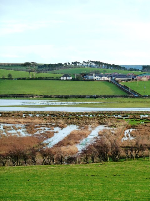
Image: © Mary and Angus Hogg Taken: 31 Dec 2013
Looking across flooded fields towards Blairbowie Farm from the A77 near Maybole. This low-lying area was the course of the combined rivers Doon and Girvan at the end of the last Ice Age. It's a good bird-watching spot at all times of the year. For a drier view, see Image
Images are licensed for reuse under creativecommons.org/licenses/by-sa/2.0
Image Location


Leaflet Map data © OpenStreetMap
Latitude
55.368005
Longitude
-4.645626