Ebury Hall, Rickmansworth (2)
Introduction
The photograph on this page of Ebury Hall, Rickmansworth (2) by David Hillas as part of the Geograph project.
The Geograph project started in 2005 with the aim of publishing, organising and preserving representative images for every square kilometre of Great Britain, Ireland and the Isle of Man.

There are currently over 7.5m images from over 14,400 individuals and you can help contribute to the project by visiting https://www.geograph.org.uk
Ebury Hall, Rickmansworth (2)
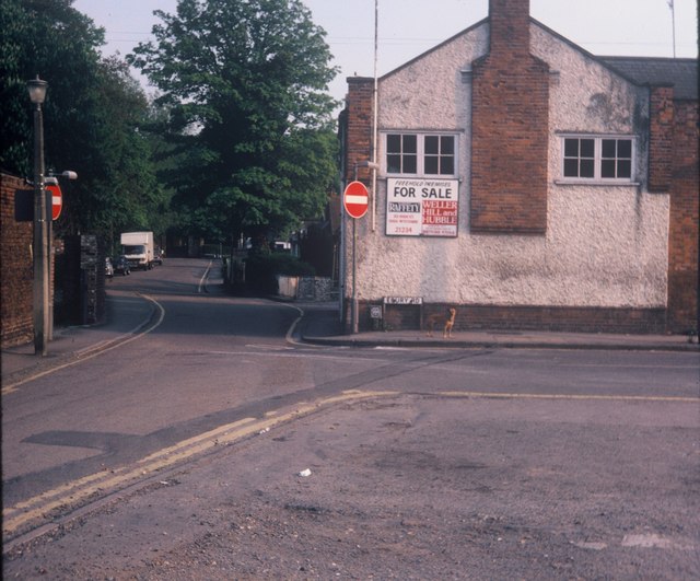
Image: © David Hillas Taken: 17 May 1982
Taken in May 1982, this photo shows Ebury Hall at the corner of Ebury Road and Bury Lane. It dates from 1901 and was named after Lord Ebury. However, it closed as a public meeting place in the late 1970s and is now used as offices. The road to the left of Ebury Hall is Bury Lane which led to The Bury in the distance. There used to be a stream, known as the watersplash, which crossed Bury Lane just beyond Ebury Hall, but it froze during the severe Winter of 1962/3 and was subsequently culverted in the Autumn of 1963.
Images are licensed for reuse under creativecommons.org/licenses/by-sa/2.0
Image Location
Latitude
51.638174
Longitude
-0.470968