Start of public footpath from Stourbridge Road, Hagley, Worcs
Introduction
The photograph on this page of Start of public footpath from Stourbridge Road, Hagley, Worcs by P L Chadwick as part of the Geograph project.
The Geograph project started in 2005 with the aim of publishing, organising and preserving representative images for every square kilometre of Great Britain, Ireland and the Isle of Man.

There are currently over 7.5m images from over 14,400 individuals and you can help contribute to the project by visiting https://www.geograph.org.uk
Start of public footpath from Stourbridge Road, Hagley, Worcs
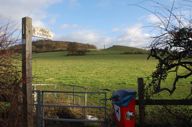
Image: © P L Chadwick Taken: 27 Dec 2013
The footpath starts here at the kissing gate, and goes to the right out of this view and connects Stourbridge Road with Monument Lane. In the distance is Wychbury Hill, on which there is an iron age fort known as Wychbury Hill Camp. The obelisk, known locally as Wychbury Monument, was built by Sir Richard Lyttelton in 1747. It was recently renovated. Image
Images are licensed for reuse under creativecommons.org/licenses/by-sa/2.0
Image Location
Latitude
52.43051
Longitude
-2.128648