Durham Place
Introduction
The photograph on this page of Durham Place by Christopher Hall as part of the Geograph project.
The Geograph project started in 2005 with the aim of publishing, organising and preserving representative images for every square kilometre of Great Britain, Ireland and the Isle of Man.

There are currently over 7.5m images from over 14,400 individuals and you can help contribute to the project by visiting https://www.geograph.org.uk
Durham Place
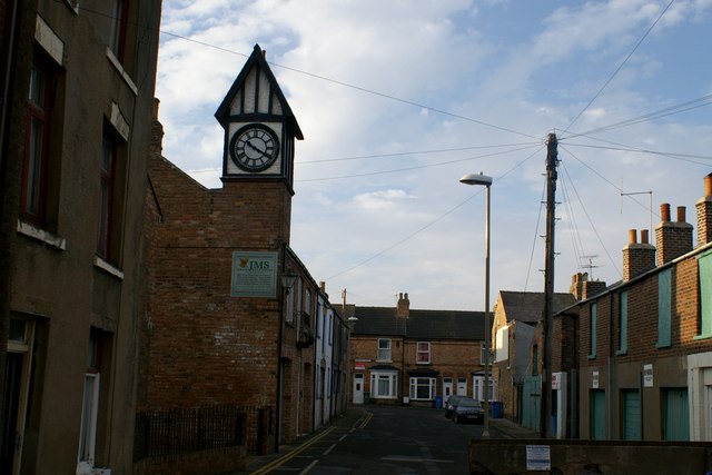
Image: © Christopher Hall Taken: 10 Dec 2013
Durham Place is a narrow street which runs off North Marine Road, but it widens out to create a little square. This street was developed in the 1860s largely as mews, stables, carriage houses, hay lofts and small servants' dwellings to serve the needs of the well-to-do residents and visitors in North Marine Road. the former stables and haylofts on the right are now garages. The building with the clock was once industrial use but has now been converted to residences. Crossing the end of Durham Place are houses on Howard Street built 1880-1883.
Images are licensed for reuse under creativecommons.org/licenses/by-sa/2.0
Image Location
Latitude
54.286312
Longitude
-0.402686