Llanbadarn Road
Introduction
The photograph on this page of Llanbadarn Road by Ian Capper as part of the Geograph project.
The Geograph project started in 2005 with the aim of publishing, organising and preserving representative images for every square kilometre of Great Britain, Ireland and the Isle of Man.

There are currently over 7.5m images from over 14,400 individuals and you can help contribute to the project by visiting https://www.geograph.org.uk
Llanbadarn Road
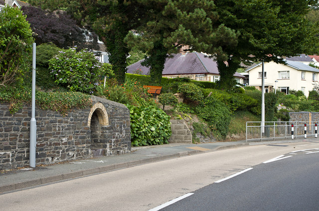
Image: © Ian Capper Taken: 3 Aug 2013
The A44 between Llanbadarn Fawr and Aberystwyth town centre. The archway in the wall on the left is marked on maps as a spout, and has been shown as such 1905; the 1889 map marks it as W, or well - see Image for close up.
Images are licensed for reuse under creativecommons.org/licenses/by-sa/2.0
Image Location
Latitude
52.411169
Longitude
-4.066849