Nos 24-28 The Mount
Introduction
The photograph on this page of Nos 24-28 The Mount by Robin Stott as part of the Geograph project.
The Geograph project started in 2005 with the aim of publishing, organising and preserving representative images for every square kilometre of Great Britain, Ireland and the Isle of Man.

There are currently over 7.5m images from over 14,400 individuals and you can help contribute to the project by visiting https://www.geograph.org.uk
Nos 24-28 The Mount
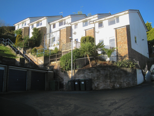
Image: © Robin Stott Taken: 10 Dec 2012
The Mount estate on a very steep slope is one of Teignmouth's more extreme residential impositions on the landscape. One's heart goes out to the architect, the builder and the residents who have had to cope at various times with the big changes of level.
Images are licensed for reuse under creativecommons.org/licenses/by-sa/2.0
Image Location
Latitude
50.553642
Longitude
-3.501192