Chester City Walls
Introduction
The photograph on this page of Chester City Walls by Jeff Buck as part of the Geograph project.
The Geograph project started in 2005 with the aim of publishing, organising and preserving representative images for every square kilometre of Great Britain, Ireland and the Isle of Man.

There are currently over 7.5m images from over 14,400 individuals and you can help contribute to the project by visiting https://www.geograph.org.uk
Chester City Walls
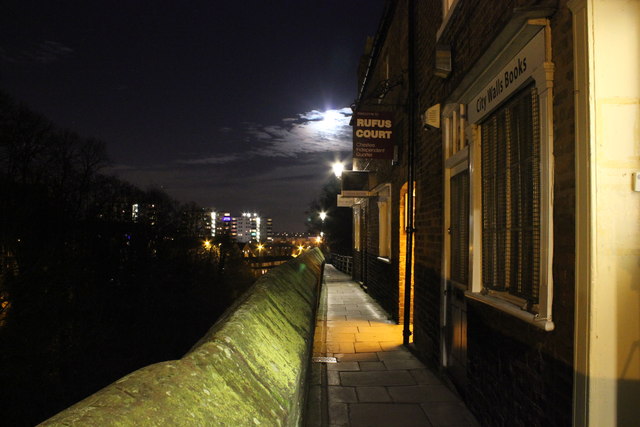
Image: © Jeff Buck Taken: 17 Dec 2013
Chester city walls near Rufus Court. Below the walls, on the left runs the Shropshire Union Canal. In the distance can be seen the lights from Newtown flats. Wikipedia http://en.wikipedia.org/wiki/Chester_city_walls
Images are licensed for reuse under creativecommons.org/licenses/by-sa/2.0
Image Location
Latitude
53.193853
Longitude
-2.892932