Nightingale Close, Barton-Upon-Humber
Introduction
The photograph on this page of Nightingale Close, Barton-Upon-Humber by Jonathan Billinger as part of the Geograph project.
The Geograph project started in 2005 with the aim of publishing, organising and preserving representative images for every square kilometre of Great Britain, Ireland and the Isle of Man.

There are currently over 7.5m images from over 14,400 individuals and you can help contribute to the project by visiting https://www.geograph.org.uk
Nightingale Close, Barton-Upon-Humber
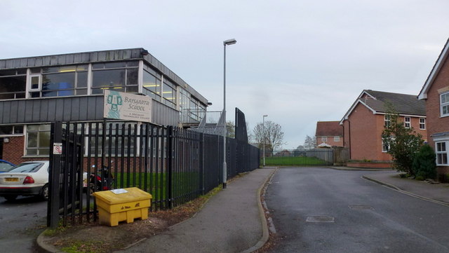
Image: © Jonathan Billinger Taken: 13 Dec 2013
To the left is the only building left from what was Barton Grammar School. It is now an outpost of Baysgarth School, the main entrance of which is on Barrow Road. See http://www.baysgarthschool.co.uk/ To the right is some recent housing on the site of the old Grammar School building established, I think, in the 1920's. See http://www.bartonuponhumber.org.uk/gramm/gramschool.htm The photographer attended the school from 1972 to its merger with Bereton Secondary Modern (to form Baysgarth) in 1975.
Images are licensed for reuse under creativecommons.org/licenses/by-sa/2.0
Image Location


Leaflet Map data © OpenStreetMap
Latitude
53.680378
Longitude
-0.436605