Tean Hall Mills
Introduction
The photograph on this page of Tean Hall Mills by Chris Allen as part of the Geograph project.
The Geograph project started in 2005 with the aim of publishing, organising and preserving representative images for every square kilometre of Great Britain, Ireland and the Isle of Man.

There are currently over 7.5m images from over 14,400 individuals and you can help contribute to the project by visiting https://www.geograph.org.uk
Tean Hall Mills
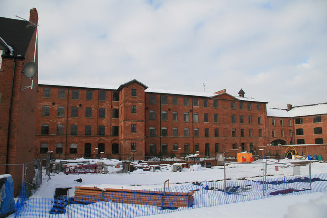
Image: © Chris Allen Taken: 5 Dec 2010
Former tape mill complex that is now housing. The satellite image shows a row of houses in the foreground that appear to have been demolished, opening up this vista.
Images are licensed for reuse under creativecommons.org/licenses/by-sa/2.0
Image Location
Latitude
52.952967
Longitude
-1.987158