Netherthorpe Tower Blocks, viewed from Upper Hanover Street, Sheffield
Introduction
The photograph on this page of Netherthorpe Tower Blocks, viewed from Upper Hanover Street, Sheffield by Terry Robinson as part of the Geograph project.
The Geograph project started in 2005 with the aim of publishing, organising and preserving representative images for every square kilometre of Great Britain, Ireland and the Isle of Man.

There are currently over 7.5m images from over 14,400 individuals and you can help contribute to the project by visiting https://www.geograph.org.uk
Netherthorpe Tower Blocks, viewed from Upper Hanover Street, Sheffield
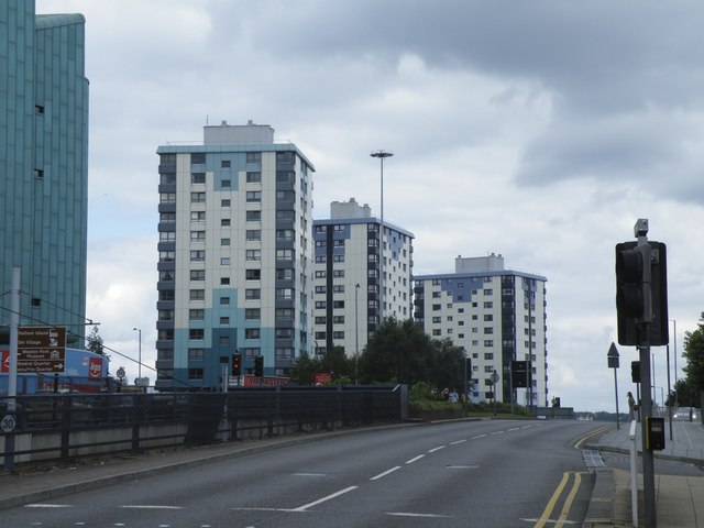
Image: © Terry Robinson Taken: 14 Aug 2012
This picture shows three of the four Netherthorpe Tower blocks which stand alongside, but not accessible from, Sheffield's Inner Ring Road. The nearest is Adamfield, then Robertshaw, then Crawshaw. A fourth block - Cornhill - is off picture to the left. These Tower Blocks were built in 1962 - to 'tie in' with the building of the Inner Ring Road - and were all re-furbished in 1998. For view the opposite way … see … Image
Images are licensed for reuse under creativecommons.org/licenses/by-sa/2.0
Image Location
Latitude
53.382964
Longitude
-1.484452