Britford Trout Farm
Introduction
The photograph on this page of Britford Trout Farm by Mike Faherty as part of the Geograph project.
The Geograph project started in 2005 with the aim of publishing, organising and preserving representative images for every square kilometre of Great Britain, Ireland and the Isle of Man.

There are currently over 7.5m images from over 14,400 individuals and you can help contribute to the project by visiting https://www.geograph.org.uk
Britford Trout Farm
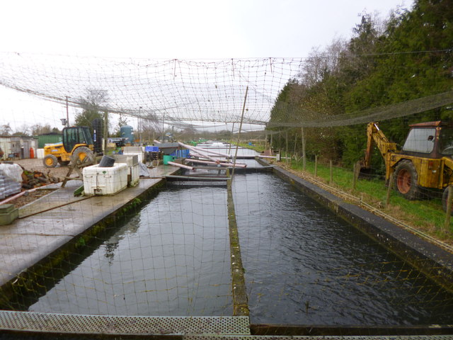
Image: © Mike Faherty Taken: 14 Dec 2013
Served by water from one of the water meadows' irrigation channels. http://www.britishtrout.co.uk/old-site/members/Britford.htm
Images are licensed for reuse under creativecommons.org/licenses/by-sa/2.0
Image Location


Leaflet Map data © OpenStreetMap
Latitude
51.052538
Longitude
-1.759124