Broughton: Bear Brook Flood Storage Area Bund
Introduction
The photograph on this page of Broughton: Bear Brook Flood Storage Area Bund by Nigel Cox as part of the Geograph project.
The Geograph project started in 2005 with the aim of publishing, organising and preserving representative images for every square kilometre of Great Britain, Ireland and the Isle of Man.

There are currently over 7.5m images from over 14,400 individuals and you can help contribute to the project by visiting https://www.geograph.org.uk
Broughton: Bear Brook Flood Storage Area Bund
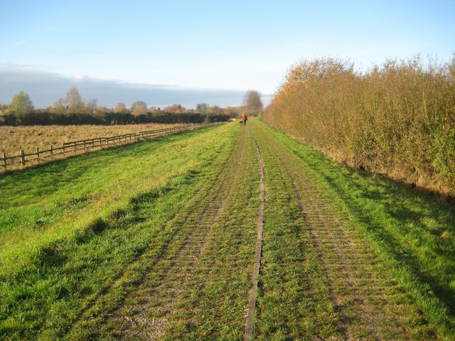
Image: © Nigel Cox Taken: 1 Dec 2013
Bear Brook has always been prone to bursting its banks, and, with the increasing residential development of Aylesbury, it became necessary in the 1990s to control any flood event by storing potential flood water upstream of the town. This long straight bund, which is about 400 metres long, forms the right side of the flood storage area, and follows the Aylesbury Arm of the Grand Union Canal. The canal is to the right, beyond the bushes in this view, and the flood storage area is to the left. The top surface of the bund is formed of "grasscrete" slabs, which are blocks of concrete with large holes in. The holes in the slabs enable grass to grow through to give a natural appearance, but the blocks themselves are still strong enough to provide a surface on which maintenance vehicles can be driven.
Images are licensed for reuse under creativecommons.org/licenses/by-sa/2.0
Image Location
Latitude
51.819834
Longitude
-0.780975