The Street at Barham
Introduction
The photograph on this page of The Street at Barham by Marathon as part of the Geograph project.
The Geograph project started in 2005 with the aim of publishing, organising and preserving representative images for every square kilometre of Great Britain, Ireland and the Isle of Man.

There are currently over 7.5m images from over 14,400 individuals and you can help contribute to the project by visiting https://www.geograph.org.uk
The Street at Barham
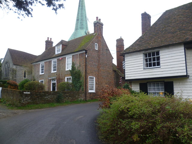
Image: © Marathon Taken: 7 Dec 2013
This is The Street as it approaches St John the Baptist Church with its green copper spire looming over the houses. The chancel and transepts of the church belong to the end of the 13th century, while the nave dates from around 1300. The tower is 14th century.
Images are licensed for reuse under creativecommons.org/licenses/by-sa/2.0
Image Location


Leaflet Map data © OpenStreetMap
Latitude
51.206729
Longitude
1.161459