Canal basin seen across the Paddington Arm of the Grand Union Canal
Introduction
The photograph on this page of Canal basin seen across the Paddington Arm of the Grand Union Canal by Marathon as part of the Geograph project.
The Geograph project started in 2005 with the aim of publishing, organising and preserving representative images for every square kilometre of Great Britain, Ireland and the Isle of Man.

There are currently over 7.5m images from over 14,400 individuals and you can help contribute to the project by visiting https://www.geograph.org.uk
Canal basin seen across the Paddington Arm of the Grand Union Canal
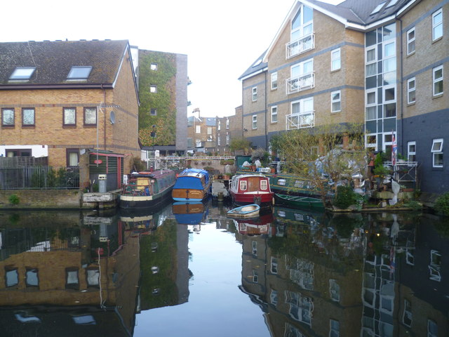
Image: © Marathon Taken: 4 Dec 2013
The Paddington Arm of the then Grand Junction Canal was opened in 1801 from Bull's Bridge near Southall to Paddington Basin. The canals were initially a success, particularly for transporting coal, building materials and other bulky loads, but the rise of the railways not long after the canals were built substantially reduced their importance. Now they are primarily a leisure facility. The Paddington Arm was one of the last to see the old-fashioned style of regular commercial traffic of paired narrow boats carrying the traditional materials such as coal, oils, and tar. The Paddington Arm now sees regular commercial traffic, usually in the form of aggregates. What was then the Central Electricity Generating Board laid cables under some of the towpaths in the 1970s and made them suitable for pedestrians again. The towpath is followed by the Grand Union Canal Walk. This section is between Ladbroke Grove and Great Western Road and looks across to a basin where some narrow boats are moored. Fermoy Road is beyond.
Images are licensed for reuse under creativecommons.org/licenses/by-sa/2.0
Image Location
Latitude
51.524973
Longitude
-0.20505