Lofthouse Colliery Nature Park, Heritage Trail #5
Introduction
The photograph on this page of Lofthouse Colliery Nature Park, Heritage Trail #5 by Mike Kirby as part of the Geograph project.
The Geograph project started in 2005 with the aim of publishing, organising and preserving representative images for every square kilometre of Great Britain, Ireland and the Isle of Man.

There are currently over 7.5m images from over 14,400 individuals and you can help contribute to the project by visiting https://www.geograph.org.uk
Lofthouse Colliery Nature Park, Heritage Trail #5
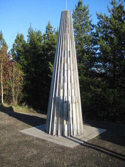
Image: © Mike Kirby Taken: 4 Dec 2013
The obelisk, a memorial to Lofthouse Colliery, which represents a mine shaft looking from the bottom upwards, hence the reducing diameter.
Images are licensed for reuse under creativecommons.org/licenses/by-sa/2.0
Image Location
Latitude
53.718969
Longitude
-1.510054