County Way heritage
Introduction
The photograph on this page of County Way heritage by Neil Owen as part of the Geograph project.
The Geograph project started in 2005 with the aim of publishing, organising and preserving representative images for every square kilometre of Great Britain, Ireland and the Isle of Man.

There are currently over 7.5m images from over 14,400 individuals and you can help contribute to the project by visiting https://www.geograph.org.uk
County Way heritage
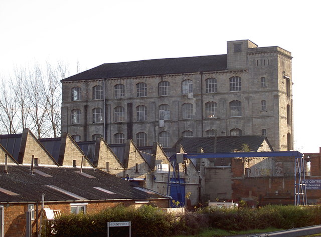
Image: © Neil Owen Taken: 26 Nov 2013
The distinctive outline of the Ashton Mills buildings along County Way. Built in the mid-nineteenth century and now Grade II listed, they have a number of small offices and industrial businesses occupying the site.
Images are licensed for reuse under creativecommons.org/licenses/by-sa/2.0
Image Location
Latitude
51.318414
Longitude
-2.201414