Bellsmyre High Flats
Introduction
The photograph on this page of Bellsmyre High Flats by Lairich Rig as part of the Geograph project.
The Geograph project started in 2005 with the aim of publishing, organising and preserving representative images for every square kilometre of Great Britain, Ireland and the Isle of Man.

There are currently over 7.5m images from over 14,400 individuals and you can help contribute to the project by visiting https://www.geograph.org.uk
Bellsmyre High Flats
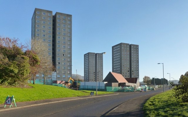
Image: © Lairich Rig Taken: 23 Nov 2013
Click on the end-note title for other views. In the present view, preparations for demolition are under way. The low building in front of the tower block on the right is the Cutty Sark Community Centre; it stands on the same site as the previous community centre, which had been called Howatshaws Hall, and which can be seen in an earlier view Image See also Image, corresponding to the present picture, but taken almost a year later.
Images are licensed for reuse under creativecommons.org/licenses/by-sa/2.0
Image Location
Latitude
55.959446
Longitude
-4.552546