Kinross: site of former Loch Leven station, 2002
Introduction
The photograph on this page of Kinross: site of former Loch Leven station, 2002 by Ben Brooksbank as part of the Geograph project.
The Geograph project started in 2005 with the aim of publishing, organising and preserving representative images for every square kilometre of Great Britain, Ireland and the Isle of Man.

There are currently over 7.5m images from over 14,400 individuals and you can help contribute to the project by visiting https://www.geograph.org.uk
Kinross: site of former Loch Leven station, 2002
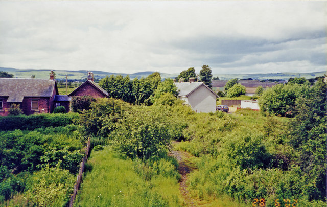
Image: © Ben Brooksbank Taken: 27 Jun 2002
View NW from a surviving bridge, towards Kinross Junction - Milnathort - Mawcarse Junction, Bridge of Earn and Perth: ex-NBR Edinburgh/Glasgow - Forth Bridge - Dunfermline - Cowdenbeath - Perth main line! The station had been closed to passengers since 1/9/21, to goods since 29/3/65. The main line to Perth was abandoned from 5/1/70 Cowdenbeath - Kelty and Milnathort - Bridge of Earn, Kelty - Milnathort from 4/5/70. Since then Perth has had to be reached by a roundabout route via Thornton Junction (now Glenrothes), Ladyburn and Newburgh. Meanwhile the M90 motorway has been built, much of it along the course of the former main line to Perth. The motorway is not quite visible in the photograph but is just behind the houses. On the skyline are the Ochil Hills, including Sludgie Hill (1,354 ft.) and Dochrie Hill (1,194 ft.). Loch Leven itself stretches behind the camera.
Images are licensed for reuse under creativecommons.org/licenses/by-sa/2.0
Image Location
Latitude
56.19753
Longitude
-3.424502