Road junction south of Llanrhaiadr-ym-Mochnant at site of former station, 2001
Introduction
The photograph on this page of Road junction south of Llanrhaiadr-ym-Mochnant at site of former station, 2001 by Ben Brooksbank as part of the Geograph project.
The Geograph project started in 2005 with the aim of publishing, organising and preserving representative images for every square kilometre of Great Britain, Ireland and the Isle of Man.

There are currently over 7.5m images from over 14,400 individuals and you can help contribute to the project by visiting https://www.geograph.org.uk
Road junction south of Llanrhaiadr-ym-Mochnant at site of former station, 2001
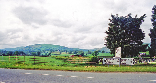
Image: © Ben Brooksbank Taken: 26 May 2001
View northward, to the Berwyn Mountains on the horizon (Mynydd-mawr (1,753 ft.) is the nearer peak, above Llanrhaiadr village). The site of the station was just behind and to the left: ex-Cambrian/GW Tanat Valley Light Railway, Oswestry - Blodwell Junction (to right) - Llangynog (to left). The station and line closed to passengers 15/1/51, to goods 1/7/52, but goods continued from here to Blodwell Junction until 6/1/64.
Images are licensed for reuse under creativecommons.org/licenses/by-sa/2.0
Image Location
Latitude
52.81549
Longitude
-3.284444