Sirhowy boundary stone
Introduction
The photograph on this page of Sirhowy boundary stone by Robin Drayton as part of the Geograph project.
The Geograph project started in 2005 with the aim of publishing, organising and preserving representative images for every square kilometre of Great Britain, Ireland and the Isle of Man.

There are currently over 7.5m images from over 14,400 individuals and you can help contribute to the project by visiting https://www.geograph.org.uk
Sirhowy boundary stone
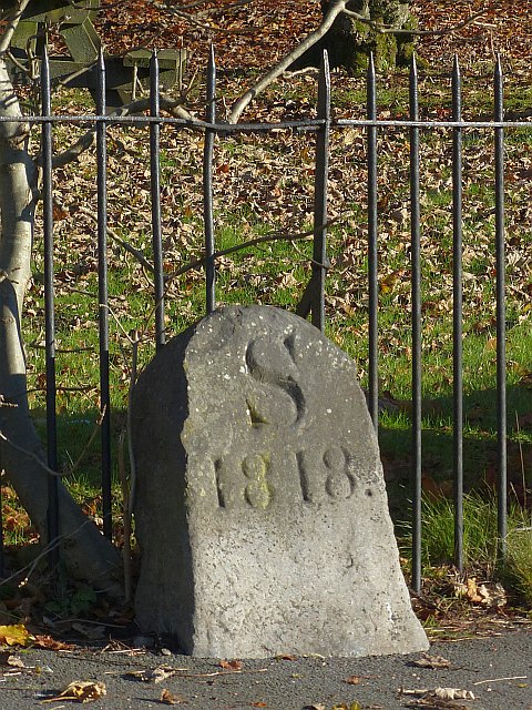
Image: © Robin Drayton Taken: 22 Nov 2013
With S for Sirhowy and the date 1818, this stone was one of a number that were erected to mark the boundary of The Sirhowy Ironworks. This followed a dispute between local ironmasters over a lease and instead of being associated with the Tredegar Ironworks, the Sirhowy Ironworks became linked with the Ebbw Vale ironworks in the next valley. The new Sirhowy owners placed these marker stones to show the boundaries of their property.
Images are licensed for reuse under creativecommons.org/licenses/by-sa/2.0
Image Location
Latitude
51.780295
Longitude
-3.242073