View of the Romford skyline from the roof of the Brewery multi-storey car park #2
Introduction
The photograph on this page of View of the Romford skyline from the roof of the Brewery multi-storey car park #2 by Robert Lamb as part of the Geograph project.
The Geograph project started in 2005 with the aim of publishing, organising and preserving representative images for every square kilometre of Great Britain, Ireland and the Isle of Man.

There are currently over 7.5m images from over 14,400 individuals and you can help contribute to the project by visiting https://www.geograph.org.uk
View of the Romford skyline from the roof of the Brewery multi-storey car park #2
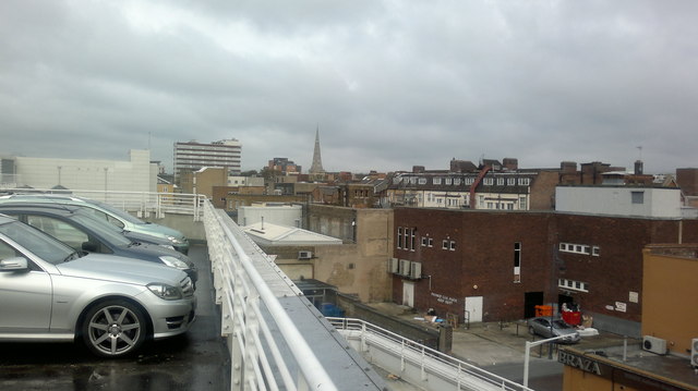
Image: © Robert Lamb Taken: 24 Nov 2013
The towerblock is an office block on St Edwards' Way called North House. Next to that is the relatively new Travelodge, built on the site of a car park for Romford Shopping Hall and in the centre of the image is the church of St Edward the Confessor in the Market Place. Looking north.
Images are licensed for reuse under creativecommons.org/licenses/by-sa/2.0
Image Location


Leaflet Map data © OpenStreetMap
Latitude
51.579232
Longitude
0.180432