Templecombe low level railway station (site), Somerset
Introduction
The photograph on this page of Templecombe low level railway station (site), Somerset by Nigel Thompson as part of the Geograph project.
The Geograph project started in 2005 with the aim of publishing, organising and preserving representative images for every square kilometre of Great Britain, Ireland and the Isle of Man.

There are currently over 7.5m images from over 14,400 individuals and you can help contribute to the project by visiting https://www.geograph.org.uk
Templecombe low level railway station (site), Somerset
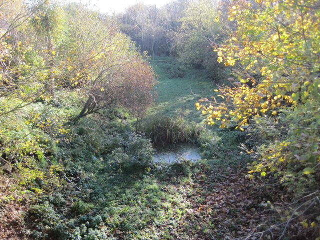
Image: © Nigel Thompson Taken: 23 Nov 2013
Opened in 1887 by the Somerset and Dorset Joint railway, this station (which was never more than one platform) closed in 1966. It had replaced an earlier station a couple of hundred metres further north, and the line continued under the London Waterloo-Yeovil line which can just be seen straight ahead on the embankment. View south towards Henstridge and Bournemouth. The single track would have run where the pond is with a single platform to the right.
Images are licensed for reuse under creativecommons.org/licenses/by-sa/2.0
Image Location


Leaflet Map data © OpenStreetMap
Latitude
51.002325
Longitude
-2.413813