Site of Letham Grange station
Introduction
The photograph on this page of Site of Letham Grange station by Ben Brooksbank as part of the Geograph project.
The Geograph project started in 2005 with the aim of publishing, organising and preserving representative images for every square kilometre of Great Britain, Ireland and the Isle of Man.

There are currently over 7.5m images from over 14,400 individuals and you can help contribute to the project by visiting https://www.geograph.org.uk
Site of Letham Grange station
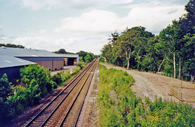
Image: © Ben Brooksbank Taken: 29 Jun 2002
View NW, towards Montrose and Aberdeen: ex-NBR Edinburgh/Glasgow - Dundee - Montrose - Aberdeen main line. The station, which probably existed primarily for Letham Grange estate and its golf courses, was closed to passenger from 22/9/30, to goods from 1/7/59; the Park is over to the right. (Cf. Image]).
Images are licensed for reuse under creativecommons.org/licenses/by-sa/2.0
Image Location
Latitude
56.598618
Longitude
-2.596216