Section of exposed walling on No.2 Guilder Lane
Introduction
The photograph on this page of Section of exposed walling on No.2 Guilder Lane by Rod Allday as part of the Geograph project.
The Geograph project started in 2005 with the aim of publishing, organising and preserving representative images for every square kilometre of Great Britain, Ireland and the Isle of Man.

There are currently over 7.5m images from over 14,400 individuals and you can help contribute to the project by visiting https://www.geograph.org.uk
Section of exposed walling on No.2 Guilder Lane
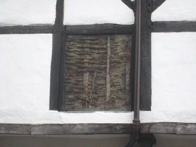
Image: © Rod Allday Taken: 7 Mar 2013
A section of the wattle and daub wall covered by a sheet of glass on this C16th timber framed house. For context see Image
Images are licensed for reuse under creativecommons.org/licenses/by-sa/2.0
Image Location
Latitude
51.069324
Longitude
-1.790721