Site of former Lamport station, 2002
Introduction
The photograph on this page of Site of former Lamport station, 2002 by Ben Brooksbank as part of the Geograph project.
The Geograph project started in 2005 with the aim of publishing, organising and preserving representative images for every square kilometre of Great Britain, Ireland and the Isle of Man.

There are currently over 7.5m images from over 14,400 individuals and you can help contribute to the project by visiting https://www.geograph.org.uk
Site of former Lamport station, 2002
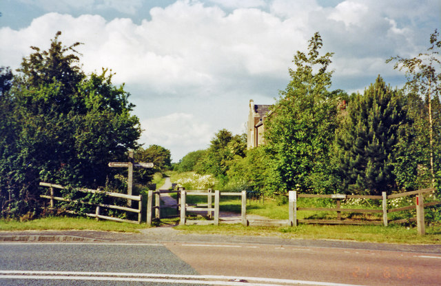
Image: © Ben Brooksbank Taken: 20 Jun 2002
View northward on A508, towards Market Harborough: ex-LNW Northampton - Market Harborough etc. line. The station house remains, following closure of the station and line to passengers from 4/1/60, but goods continued along the route until 31/5/80. Subsequently the route has been converted to a bridleway, a short stretch of which from Pitsford & Brampton has been restored since 1984 by the heritage Northampton & Lamport Railway. (Cf. Image]).
Images are licensed for reuse under creativecommons.org/licenses/by-sa/2.0
Image Location
Latitude
52.369447
Longitude
-0.899124