Tap O' Noth
Introduction
The photograph on this page of Tap O' Noth by Alan Findlay as part of the Geograph project.
The Geograph project started in 2005 with the aim of publishing, organising and preserving representative images for every square kilometre of Great Britain, Ireland and the Isle of Man.

There are currently over 7.5m images from over 14,400 individuals and you can help contribute to the project by visiting https://www.geograph.org.uk
Tap O' Noth
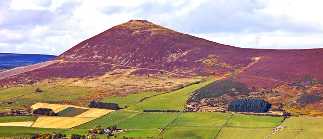
Image: © Alan Findlay Taken: 8 Oct 2013
Vitrified hill fort situated at 563 metres above sea level, Image View from Suie hill viewpoint.
Images are licensed for reuse under creativecommons.org/licenses/by-sa/2.0
Image Location
Latitude
57.304111
Longitude
-2.759288