Path and road into Priory Park, Warwick
Introduction
The photograph on this page of Path and road into Priory Park, Warwick by Robin Stott as part of the Geograph project.
The Geograph project started in 2005 with the aim of publishing, organising and preserving representative images for every square kilometre of Great Britain, Ireland and the Isle of Man.

There are currently over 7.5m images from over 14,400 individuals and you can help contribute to the project by visiting https://www.geograph.org.uk
Path and road into Priory Park, Warwick
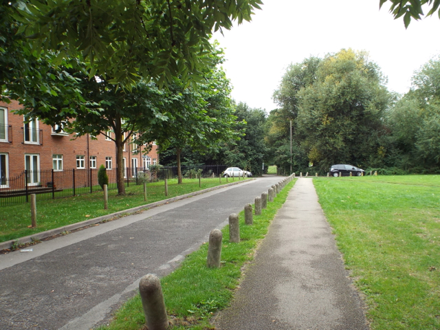
Image: © Robin Stott Taken: 13 Sep 2013
The road mainly serves Warwick Children's Centre and Nursery School, among the trees, centre, allowing a safe drop-off for car-borne tots. An informal path continues into the main area of the park. On the left is the park frontage of Woodville Court, flats developed on the site of a VW dealership and garage.
Images are licensed for reuse under creativecommons.org/licenses/by-sa/2.0
Image Location
Latitude
52.285008
Longitude
-1.581283