Warland Upper Lock No 35, Rochdale Canal
Introduction
The photograph on this page of Warland Upper Lock No 35, Rochdale Canal by Dr Neil Clifton as part of the Geograph project.
The Geograph project started in 2005 with the aim of publishing, organising and preserving representative images for every square kilometre of Great Britain, Ireland and the Isle of Man.

There are currently over 7.5m images from over 14,400 individuals and you can help contribute to the project by visiting https://www.geograph.org.uk
Warland Upper Lock No 35, Rochdale Canal
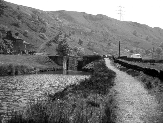
Image: © Dr Neil Clifton Taken: 30 May 1974
This is taken looking southwards, (actually slightly south-eastwards) and shows the unrestored lock as it was in 1974. This lock is in the West Riding of Yorkshire, but the County boundary crosses just further away than the lock, and the white house seen to the right, which is actually the lock cottage at the next lock (Long Lees Lock No 36) is in Lancashire.
Images are licensed for reuse under creativecommons.org/licenses/by-sa/2.0
Image Location
Latitude
53.677336
Longitude
-2.084737