Enclosed footpath from Winmarith Drive
Introduction
The photograph on this page of Enclosed footpath from Winmarith Drive by Anthony O'Neil as part of the Geograph project.
The Geograph project started in 2005 with the aim of publishing, organising and preserving representative images for every square kilometre of Great Britain, Ireland and the Isle of Man.

There are currently over 7.5m images from over 14,400 individuals and you can help contribute to the project by visiting https://www.geograph.org.uk
Enclosed footpath from Winmarith Drive
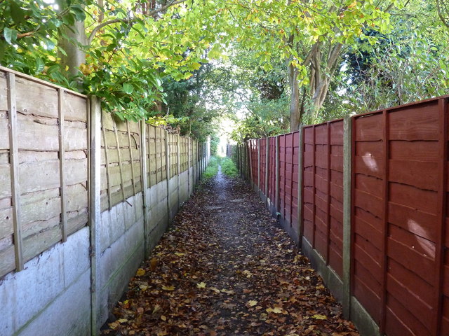
Image: © Anthony O'Neil Taken: 9 Nov 2013
It seems unlikely that the current residents here realise that this path is all that remains of the right-of-way, across open farmland, from Hale Road to Warburton Green. The 1950s building boom in Hale Barns obliterated most of the meadows, copses and fields that surrounded it before the War. There is a (1954) watercolour sketch of the meadow - belonging to Prospect House - which once bordered the brown fence (formerly iron railings) to the right of the photo. Just beyond these railings was a stand of massive beech trees, with a rookery. The meadow was ankle deep in daisies, buttercups, clover and rough grass. Several ponies grazed there, and the nearby pond attracted dragonflies in the summer months. What a change!
Images are licensed for reuse under creativecommons.org/licenses/by-sa/2.0
Image Location
Latitude
53.364984
Longitude
-2.306971