All Saints Church, Banstead
Introduction
The photograph on this page of All Saints Church, Banstead by Marathon as part of the Geograph project.
The Geograph project started in 2005 with the aim of publishing, organising and preserving representative images for every square kilometre of Great Britain, Ireland and the Isle of Man.

There are currently over 7.5m images from over 14,400 individuals and you can help contribute to the project by visiting https://www.geograph.org.uk
All Saints Church, Banstead
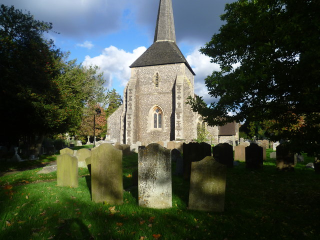
Image: © Marathon Taken: 4 Nov 2013
The large churchyard of All Saints, Banstead lies just off the High Street. The tower dates from the late 12th or early 13th centuries but the spire is later.
Images are licensed for reuse under creativecommons.org/licenses/by-sa/2.0
Image Location


Leaflet Map data © OpenStreetMap
Latitude
51.32195
Longitude
-0.201075